
Quebec City, Canada
(Conference summary reproduced with permission; original text published in: Häusler, H. 2009. Report on National and International Military Geo-Conferences held from 1994 to 2007, MILGEO, Nr. 30E, Austrian Ministry of Defence and Sports).
This conference was jointly organised by Laval-University and Valcartier (Defence Research and Development Canada). The four days conference was held at Laval University campus situated about six km west of Old Québec City. The organising committee comprised personnel from civil and military organisations.
It was jointly organised by Jean Martin from the Department of National Defence at the Directory of History and Heritage (Ottawa; see also MARTIN, 2003), by Yves van Chestein from the Defence Research and Development Canada (Valcartier), by Marc St-Hilaire from the Department of Geography at Université Laval (supported by Michel Allard and Guy Mercier), and by Sarah J. Meharg from the Pearson Peacekeeping Centre in Ottawa.
According to the abstracts, about twenty-eight participants came from the United States of America, eight from Great Britain and also from Canada, two from France as well as from Austria, and one from South Africa.
The contributions were well balanced offering interesting papers on military geography and cartography, military geology, battlefield archaeology, intelligence, and tactics (Table 8). This choice was primarily the merit of the Advisory Board consisting of high-ranking military and renowned civil personnel such as Colonel Eugene Palka (Deputy Department Head, Department of Geography and Environmental Engineering, U.S. Military Academy, West Point), Lt. Colonel Francis Galgano (Geography Program Director, U.S. Military Academy, West Point), Russell Harmon (Senior Program Manager for Terrestrial Sciences, Environmental Sciences Division, U.S. Army Research Office), Dr. Eduard P. F. Rose (Honorary Research Fellow, Department of Geology, Royal Holloway, University of London, UK), Dr. Paul Nathanail (Head of Land Management Group, School of Chemical Environmental and Mining Engineering, University of Nottingham, UK), and Univ.-Prof. Dr. André-Louis Sanguin (Institute of Geography, Université Paris-Sorbonne, France). Within 6 plenary sessions, sixteen sessions, and one special session about fifty lectures were presented during four half days, each afternoon offering fieldtrips to Québec City and its surroundings and therefore giving enough opportunity for personal communication, which was deepened during the evening program. Nearly each of the fifty conference participants contributed to one or two of the following sessions (1-16), which were chosen according to the contributions accepted:
- The World Wars in Europe
- Urban Terrain
- Evolution of warfare and military geography
- Spatial Analysis
- Geology and Supply, then and now
- Geology and Maps pre-1939
- Battlefield Archaeology
- Maps, Names and GIS
- Soil and Technology
- Tactics and Terrain
- Cultural Geography at Urban Scale
- GIS and Old Battlefields
- Modern Warfare
- War, Landscape and Culture
- Battlefield Reconstruction
- Geology and Warfare in Third World Countries
About six lectures were presented per half day at two different lecture rooms, each lasting fifteen minutes and offering five minutes for discussion. Depending on the major interest of the participants some had to hurry from one lecture room to the other, in order to listen to the lectures chosen. In addition to the sessions listed above, a special session was held on the “Evolution of Teaching Military Geography” with lectures from Ted Rose (Royal Holloway, London), Eugene Palka (U.S. Army Military Academy, West Point), Reinhard Mang (Institute for Military Geography, MoD Vienna, Austria), and Jason Strokes from Claremont Graduate University.
The following comments on lectures of the 7th ICMG are very personal ones by the author, who knew only few colleagues of this military geosciences community before. First, we report on lectures on military geology (a) and second on those on military geography (b) in order of the sessions presented. Number of lectures presented for each discipline is added in parenthesis.
a) Lectures predominantly relating to military geology (10)
An outstanding lecture referring to military geology was given by Peter Doyle & Richard Burt (UK) on “Geology and the Construction, Bombing and Storming of Pointe Du Hoc, Normandy, 1944” a classical dependency of tactical advantages and disadvantages of fractured Jurassic marl- and limestone after bombing and shelling as studied within U.S. University student site surveys 2004-2006 (session 1). Professor Peter Doyle is a Consultant Geologist in the UK and – of course besides Ted Rose – one of the British geologists most engaged in the history of military geology. The contribution of Christopher A. Gellasch from the U.S. Army Center for Health Promotion and Preventive Medicine – West on the “Evaluation of Groundwater Wells Utilized by U.S. and Coalition Forces in Afghanistan” clearly demonstrated the use of geologic knowledge for the exploration of drinking water under the Combined/Task Force –76 (session 5).
Most impressive for one of the authors (H.H.) was to meet the senior geologist Maurice J. Terman from the United States Geological Survey (USGS) in Reston, Virginia. As scientist emeritus he was responsible on the international programs of the USGS, in particular for circum-pacific geospatial data projects. He presented “Post World War II USGS Team Prepared Terrain Maps for Germany” compiled by the Engineer Intelligence Center of the Heidelberg headquarters of the U.S. Army Europe (USAREUR). Their principal focus was the publication of 131 maps entitled “Cross- Country Movement” at a scale of 1 : 100 000 for all of Germany, and of 24 maps entitled “Military Engineering Geology” at a scale of 1 : 250 000 for the former Western Germany (session 8).
Two lectures from members of the U.S. Desert Research Institute, Division of Earth and Ecosystems, referred to the theme “Soil and Technology” in session 9. Thomas Bullard gave a lecture on “Maintenance of Military Training: Soil Geomorphic Applications” and Eric McDonald on “Integrated Terrain Forecasting for Military Operations: Predicting the Location of Critical Soil Conditions Using Geomorphic Image Analysis”. Maps offering essential geomorphologic, lithologic and soil information are based on GIS databases on lithology and soils cross-linked to their physical attributes. Based on high resolution remote sensing imagery (e.g. MASTER, ASTER) and intensive field examinations of desert test fields allow for systematic determination of the relations between landscape position, physiogeography, soil surface and sub-surface properties.
Hermann Häusler from Vienna University (Austria) reported on the “Improvement in German Military Geology from the Napoleon Wars to World War I“ (session 10). Peter Doyle from Department of Earth Sciences, University College London (UK) and Karl W. Lambach (Human Systems Research Inc., Las Cruces, New Mexico (USA) jointly recorded aspects of “Military Geology and the Apache Wars, South West United States” (session 12). Edward P. F. Rose from Royal Holloway, University of London (UK) probably has written most contributions to the history of military geology, either alone or together with other authors such as Mike Rosenbaum, and others (e.g. ROSE & NATHANAIL, 2000). His plenary presentation on the Geological Section of the British Army compared to the U.S.- and German war geologists in WWI was a milestone of infotainment – results from intensive archive studies on worldwide terrain evaluation by the British Inter-service Topographic Department – humorously presented in clearly understandable English. Great! Hermann Häusler and Reinhard Mang (Institute for Military Geography, MoD, Austria) jointly reported on „Military Geoscientific Excursions to Theatres of WWI in France and Belgium“, where also Canadians fought the German troops (session 12; see also MANG & HÄUSLER, 2006). Stephen Hendersen from Emory University (USA) spoke on “The Geology and Geography of Forbes Road and the Battle of Bushy Run, Pennsylvania during the French and Indian War and Pontiac’s War 1758-1763” (session 15). These two lectures given by Häusler & Mang and by Hendersen, each on geology and geography of battle fields, lead up to lectures predominantly relating to military geography, as referred to in more detail in the next paragraph.
b) Lectures predominantly relating to military geography (39)
Referring to the definition of COLLINS (1998, p.3) military geography “concentrates on the influence of physical and cultural environments over political-military policies, plans, programs, and combat/support operations of all types in global, regional, and local contexts”. In a pragmatic way we group contributions of the Québec 2007 conference more related to geography in terms of cartography, topography, environment and ecosystems. Many historical lectures highlighted geographical factors for tactical decisions. A few lectures dealt with remote sensing, and archaeology. A special session was inserted for teaching of military geography. If a team of authors had announced an abstract, we only commented the speaker(s) of the oral presentation. For further details we refer to the abstract volume in the web.
Terrain & Tactics (8) – About 20% of the lectures on military geography dealt with terrain evaluation for tactical decisions as demonstrated in several historical case studies. Michael B. Barrett from the History Department of The Citadel (Charleston, South California, USA) reported on the “Russian Defense of the Baltic Sea, 1912-1917” (session 1), Mark G. Smith from Langara College (Canada) gave a geographical interpretation of “The Battle of Dunkirk, 1940” supposing that experiences from WWI hindered German troops to send tanks into battlefields rich in water obstacles in WWII (session 1). David C. Hsiung from the History Department of the Juniata College (Huntington, Passadena, USA) analysed “Food, Fuel, and the New England Environment in the War for Independence, 1775-1776” (session 5), and two organisers of the Québec Conference, Jean Morin and Jean Martin presented the tactical advantages of the Vimy Ridge (situated near Lille in France) on the occasion of the 90th anniversary of the victorious Canadian battle of Vimy in April 1917 (session 6). Roy P. Bradshaw from the School of Geography, University of Nottingham (UK) stressed the strong terrain of the Battle for Monte Cassino in January 1944 (session 10), and Kurt A. Schroeder from the Social Science Department, Plymouth State University (Plymouth, New Hampshire, USA), reported on “Strategy and Tactics of the French War in Indochina, 1946-1954” (session 10). Robert J. Abrahart from the School of Geography, University of Nottingham (UK) presented the decisive factors of terrain and weather in his lecture on “Mud, Funnel Effects and Regional Terrain Factors at the Battle of Agincourt 1415” for Anglo-Welsh and French troops, and Kyle S. Sinisi from the History Department of The Citadel (Charleston, South California, USA) reported on maps of the Battle of Westport in 1864 (both session 15).
Cartography (4) – Dealing with cartography, Richard D. Ewing from the U.S. National Geospatial-Intelligence Agency presented “The Image City Map” (session 2), Dave Anderson from MITRE Corporation (a non-for-profit organization chartered to work in the public interest) reported on geographic feature datasets (session 4), Brian Hagan from the Political Geography Division, U.S. National Geospatial- Intelligence Agency on “Geographic Names Transactional Gazetteer” (session 8), and Yaïves Ferland from Defence Research and Developing Canada (DRDC Valcartier, Canada) spoke on the “Transformation of Military Cartography: Situation Awareness, Toponymy, and Visualization” (session 11).
Topography (5) – Lectures pronouncing topography were given by Samantha J. Foxton from the Department of Oceanography, U.S. Naval Academy, Annapolis (USA; session 2), by John Peaty from the UK Defence Geographic Centre on “Haig´s Relief Maps” from the Western Front 1918 (session 6), and by Hennie Smit from Military Science, Stellenbosch University (South Africa) on the “Modder River during the Anglo Boer War” (session 7). Ray Caputo from the U.S. Army Corps of Engineers Topographic Engineering Center (TEC; Alexandria, Virginia, USA) presented a lecture on the “U.S. Army Use of Georeferenced PDF (GeoPDF)” and distributed CDs of a free GeoPDF toolbar provided by TEC (session 8), and Jason E. Strakes from Claremont Graduate University (California, USA) summarised his doctoral thesis on “Topography and Warfare in Third World Conflicts: 1950-2000” (session 16).
Environment & Ecosystems (5) – Lectures on specific environmental issues were given by William C. Mahaney from York University (Toronto, Canada) regarding “Hannibal´s Mountain Military Operations” (session 5), by Chris Pearson from Bristol University (UK) on the “Military Mobilisation of the French Environment, 1940-1946” (session 14), and by Alana Ramsay from Queen´s University (Kingston, Canada) on “Military Canvas Art and Canadian Collective Identity” (session 14). In the “Spatial Analysis Session” (session 4) two very interesting lectures were presented dealing with integrated terrain analysis and the natural environment, partly referring to the book of BAILEY (1998) on ecosystems, which unfortunately is out of stock. Steve N. Bacon from the U.S. Desert Research Institute, Division of Earth and Ecosystems, reported on maps of desert areas of strategic interest at a scale 1 : 750 000, and U.S. Army test sites in desert areas. William W. Doe III from the Center for Environmental Management of Military Lands, Colorado State University (USA), introduced to the “train as it fights”-doctrine presenting “A Military Geography of Natural Environments for Testing and Training: Developing Spatial Analogs for an Expeditionary Army” within a worldwide classification of U.S. combatant command regions. This approach results in the delineation of Military Operating Environments (MOE), regarding environmental security driven conflicts as well as the threat of climate change to national security.
Remote Sensing (2) – A lecture on the very first use of aerial photography at the Western Front 1918 was given by Hugh Hamilton from Nottingham Trent School of Art & Design, Nottingham Trent University (UK; session 6), and a very recent aspect of “geophysical remote sensing”, an electromagnetic survey using an airborne magnetometer for surface and subsurface explosive items and artefacts was presented by Mark R. Graves from the U.S. Engineer Research and Development Center, Environmental Laboratory (ERDC; Vicksburg; session 9).
Archaeology (2) – Peter L. Guth from the Department of Oceanography, U.S. Naval Academy in Annapolis off ered battlefi eld archaeology, GIS and military terrain analysis of “The Battle of Big Hole (Montana, USA, 1877)” (session 7). Robert C. Whisonant from the Department of Geology, Radford University (Redford, Virginia, USA) reported on GPS/GIS technology for the inventory and assessment of battlefield features from the “Civil War Battles for Saltville, Virginia” dating back to 1864 (session 12).
Recent Case Studies on Military Geography (8) This paragraph of lectures on military geography comprises actual problems from local to global dimension, encompassing cultural geography at urban scale to the politico-military perspective of terrorism.
Douglas Bartson from the U.S. National Geospatial-Intelligence Agency reported on “The Value of Unclassified Urban Geographic Data in Military Planning” (session 2), and Evan T. Davies gave an overview on “Cultural Intelligence”, mission and work of the Political Geography Division of the Geospatial-Intelligence Agency (session 11). Dawn A. Morrison from the U.S. Army Corps of Engineers, Engineer Research and Development Center, Construction Engineering Research Laboratory (ERDC-CERL) presented a lecture on culturally oriented situational awareness in urban operations (session 11). Bénédicte Tratnjek from Université Paris IV (France) continued this topic in her lecture on “L´influence de la Géographie dans les Opérations Militaries en Milieu Urbain” (session 13). Two further lectures of session 13 on “Modern Warfare” dealt with the very actual and complex problem of terrorism. Francis A. Galgano from the Department of Geography and Environmental Engineering, U.S. Military Academy (USMA, West Point, New York) analysed the “Geographic Dimension of the Global War on Terror”, in particular the humanitarian issue in weak and failing states (GALGANO, 2006), and Tim Ryan from the California State University (Northridge, USA) presented a politico-military perspective of “Geostrategy and the Long War”, assessing the “strategic energy ellipse” drawn from Russia down to the Oman in the war on terror. Deborah Thien from California State University (Long Beach, California, USA) presented “The Emotional Geographies of the Royal Canadian Legion” (session 14). Eugene J. Palka from the Department of Geography and Environmental Engineering (USMA, West Point, New York) gave an outstanding lecture referring to military geography on “Afghanistan’s Landmine Tragedy”, a GIS approach on distribution and density of mines where remote sensing methods, and in particular aerial geophysics, could be useful (session 16).
Education in Military Geography (3) – An additional special session dealt with “The Evolution of Teaching Military Geography”. Two professional teachers in military geography, namely Eugene Palka from the U.S. Army Military Academy (West Point) and Reinhard Mang from the Institute for Military Geography (MoD, Vienna, Austria) pointed out their view on definition, education and training of military geography. Whereas Eugene Palka favoured military geography as a “Subfield of Geography, which applies geographic information for the military”, Reinhard Mang introduced the term “model of the geospace” as a prerequisite for geospace-oriented military decision-making. Although military geography is taught at all military academies, military geology as such is not, which was also stated by Ted Rose, Royal Holloway University (London, UK). Probably an exception is Austria where lectures on military geology are given at Vienna University by Hermann Häusler.
Probably the most interesting lecture of this conference was presented by the guest speaker Philippe Boulanger from Université de Paris-Sorbonne on the French Military Geography in the 19th andv 20th century and the change of paradigm after 1945 (see also BOULANGER, 2002).
To sum up, contributions on military geography reached about 80% and those on military geology about 20% on the 7th International Conference on Military Geology and Geography at Québec 2007. Although this classification of lectures regarding the scientific disciplines of “geology” and “geography” is somehow very subjective, statistics reveal, that – in contrary to previous conferences, such as Seattle (1994), Warwick (1996), and Toronto (1998) – where lectures on military geology prevailed, in the last conferences the contributions to military geography increased.
c) Field trips and post-conference tour
One plenary session and four sessions in the morning offered a broad spectrum of historical and recent aspects of military geology and military geography every day. Hence afternoon excursions were appreciated by the foreigners to learn more on the prospering country and its long history, and furthermore to use more time for discussions with old and new colleagues from the U.S., UK, Canada and France. The program of the first three days offered fieldtrips to Old Québec City and the Citadel (Monday), to the Geology of the Québec City area, followed by a cruise on the St. Laurent River (Tuesday), and to the Defence Research and Development Canada at Valcartier (Wednesday).
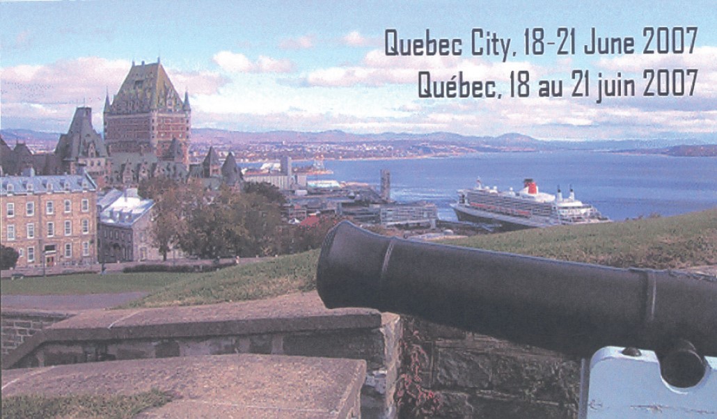
Old Québec City and the Citadel – It was Jaques Cartier (1491-1557) who discovered Canada in 1534 for the French Crown. In 1608 Samuel de Champlain established a trading post on Place-Royale, and in 1745 the fortress of Québec was built in the Vauban style.
The Seven Years War between France and Great Britain (1756-1763) was drawing to an end in North America. In 1759 British troops laid claim to Québec City, and most buildings were destroyed. In 1763 France signed the Treaty of Paris and surrendered New France to England. Upon signing the Québec Act in 1776, England yielded the territories south of the Great Lakes to Québec, thereby intensifying disputes with the Thirteen Colonies. In 1775 the Americans declared war on Québec and fought for their independence from England. In 1812 Canada was at war with its neighbour. Fearing future boundary disputes, England built the Québec Citadel and the Martello Towers on the Plains of Abraham. In 1867 the Dominion of Canada became an autonomous nation and member of the British Commonwealth. In 1985 UNESCO ranked Québec City, the cradle of French civilisation in North America, a World Heritage Site. Located on Cap Diamant, the Citadel constitutes the eastern flank of Quebec’s fortifications and is known as the Gibraltar of America. Its star-shaped layout is characteristic for Vauban fortifications of the late 17th century in France. Military traditions are maintained through military ceremonies held during the summer. The Citadel is the official residence of the Governor General of Canada since 1872. A visit of the Citadel Museum of the 22nd Franco Canadian Regiment was organised by Major (ret´d) Jean Morin, who also invited the conference members to the Officer’s Mess.
Geology of the Québec City – Two plenary lectures on the geology of Québec Province in general and on the excursion area in particular were given by Jean Martin and by professeur Michael Rocheleau (Département de géologie et de génie géologique; Faculté des sciences et de génie, Université Laval). A fieldtrip guidebook was provided prior to the excursion, which also informed on landslides and earthquakes in Québec City (P. CÔTE et al., 2007; http://www.cgq-qgc.ca/fieldtrip).
A view on the famous outcrops in the Montmorency River north of the “Parc de la Chute-Montmorency” revealed Precambrian gneiss unconformably overlain by the Trenton limestone of Ordovician age, which is rich in crinoids. The Montmorency fault cuts the edge of the former St. Laurent Platform, whereas the Orléans Island (situated opposite in the St. Laurent River) consists of Cambrian to Ordovician rocks belonging to the Appalachians, which were thrusted over the Laurentian block in the Lower Devonian, some 350-400 million years ago. This geological fieldtrip east of Québec City was followed by a cruise on the St. Lawrence River where the great scenery and a board buff et at sunset enabled the conference newcomers to get acquainted with other colleagues.
Conference participants staying at the University Campus daily passed a nice geologic nature trail on the way to the modern conference building.
About 30 impressing boulders with fossils such as stromatolites, rocks and economic minerals surround six weather resistant panels, which very well explain the geology of Québec Province. For more popular information on the geology of Québec City and its surroundings we refer to the “Carte Géotouristique” on “Géologie du Sud du Québec, du Bas-Saint-Laurent et de la Gaspésie”, available in the Renaud-Bray bookshop in Québec.
Defence Research and Development Canada at Valcartier – The third excursion led to the Research and Development Center of the Canadian Army at Valcartier, situated northwest of Québec City. An introduction to the history of this former militia training camp, which was settled along the Jaques-Cartier River lower valley, was given by Yaïves Ferland from the Geomatics faculty of Laval University. The credo for R&D of new military technology such as the hyperspeed tunnel to study launching of satellites, electronic and optoelectronic researches on laser and infrared, and computer systems is best described by the saying of Sir Winston Churchill that “The battle line of tomorrow runs through the research laboratories of today”.
Since pollution of the groundwater with TCE from the Garrison Valcartier Base affected the environment, environmental protection has become a fundamental issue of the Canadian Army. Trichloroethylene is a chlorinated hydrocarbon used as industrial solvent; and in particular for metal degreasing. A researcher of the “Institut national de la recherche scientifique” of Québec University gave very informative explanations on the hydrogeology of the glaciofluvial and glaciomarine sediments at Valcartier, on the contamination risk, and on groundwater treatment by injections and a multi reactive barrier system. The excursion culminated in a delicious dinner with a good glass of wine in the restaurant Chaumière Juchereau Duchesnay.
From St. Lawrence River to the Great Lakes – When the conference was closed on Thursday, a couple of participants took the chance taking part in the post-conference tour from St. Lawrence River to the Great Lakes, organised by Jean Morin (Directorate of History and Heritage, National Defence Headquarters, Ottawa, Ontario). The route to Montreal passed Trois-Rivières and Lake St-Pierre (Cpt. H. W. Bayfi eld and the charting of River St. Lawrence, 1827-1840). The program of the next day offered Fort Chambly and Fort Lennox, both situated on the Richelieu River with an overview of the Battle of Chryler´s Farm of the War in 1812. In Kingston the group visited Fort Henry and the Royal Military College. A full day’s program was dedicated to Toronto, the famous Niagara Falls, and the Battle of Queenston heights (near Niagara). The tour back to Québec passed the capital of Canada with a visit of the Canadian War Museum at Ottawa.
Acknowledgements and Outlook
It is a pleasure for the Austrian conference participants to particularly thank Jean Martin from the Department of National Defence, Canada, the driving force of the conference, obviously well supported by Marc St-Hilaire of Laval University and by the International Advisory Board, listed at the beginning of our report. Daily programs, infrastructure for participants, coffee breaks, lunch and dinner, excursions and handouts have been perfectly organised.
On the occasion of the closing ceremony Jean Martin opened the floor for a vivid discussion on the future of this type of conferences, their objectives, and the question if an own international society on military geology and military geography or even on military geosciences should be founded.
This discussion certainly will continue. As highest-ranking military, Brigadier General Dr. Reinhard Mang thanked the organisers of this very successful Canadian conference and offered to host the next conference in Vienna, Austria.
(Association Secretary notes – papers from this conference have yet to be published, although it is hoped that some will come out in a compendium volume of papers from the 2007, 2011 and 2013 and 2015 conferences.)